
Mapping vegetation fuels for better wildfire risk understanding
Wildfires do not spread through landscapes at random. Their behaviour depends on weather, terrain, moisture, ignition condition - and especially on the vegetation that burns.
FUELFUSION combines drone data, stallite imagery, LiDAR and artificial intelligence to map the fuels that shape how fires start, spread and intensify.
Drone imagery
Ultra-high-resolution multispectral data
LiDAR Scanning
Precise vegetation height & structure
Satellite Data
Broader regional-scale mapping
AI Classification
Vision Transformer fuel-type models
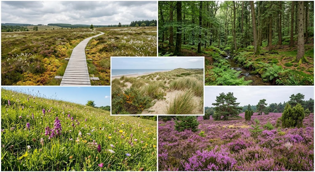
Why fuel mapping matters...
Vegetation is the fuel that drives wildfire spread. Grasslands, shrubs, broadleaf forests and conifer forests all burn differently. Their height, density, structure and spatial arrangement influence how quickly a fire may move and how intense it may become.
Good fuel maps help anwser questions such as:
-
- Where are the most flammable vegetation types located?
- How might a fire move through a specific landscape?
- Which areas may require fuel management or risk reduction actions?
- How can fire-behaviour models be supplied with more realistic input data?
What does FUELFUSION do?
FUELFUSION combines multiple sources of Earth observation data to map vegetation fuel types at different scales. The project uses information from:
Drone-based multispectral imagery
To observe vegetation in very high detail
LiDAR laser scanning
To measure vegetation height and structure, including canopy and understory layers
Satellite imagery and aerial data
To support broader regional mapping
Artificial intelligence models
To classify vegetation into meaningful fuel types
From fuel maps to fire-behaviour modelling
Fuel maps are a key input for fire-behaviour simulation models
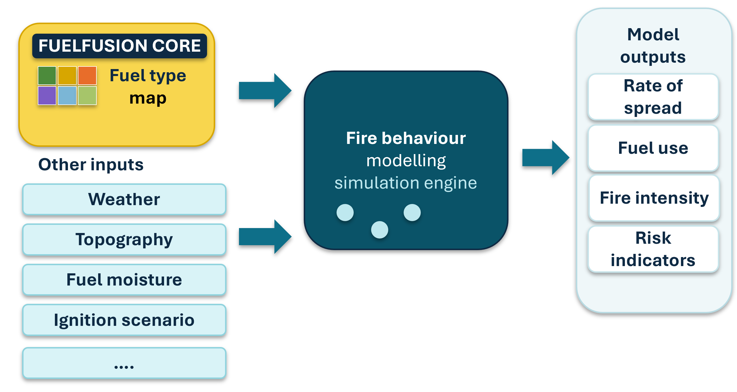
Diagram showing a fuel type map and other inputs flowing into a fire-behaviour simulation engine, producing outputs such as rate of spread, fuel use, fire intensity and risk indicators.
Two complementary mapping scales
FUELFUSION works at two different but connected scales.
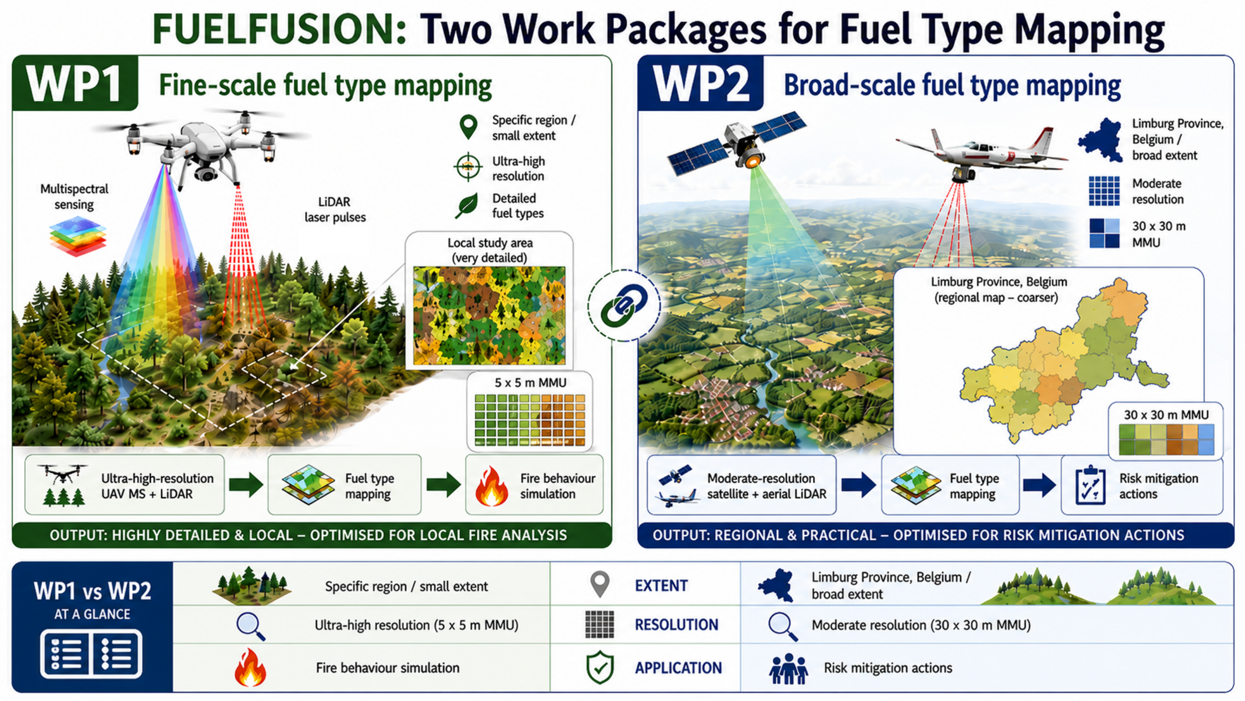
Diagram showing two FUELFUSION work packages: fine-scale fuel type mapping for local fire analysis and broad-scale fuel type mapping for regional risk mitigation.
Work Package 1: Fine-scale fuel type mapping
At the local scale, FUELFUSION uses ultra-high-resolution drone imagery and LiDAR data to map vegetation fuel types in great detail. This approach is designed for specific study areas where detailed local information is needed.
Work Package 2: Broad-scale fuel type mapping
At the regional scale, FUELFUSION uses satellite imagery and aerial LiDAR data to produce fuel type maps over larger areas, useful for planning and risk mitigation.
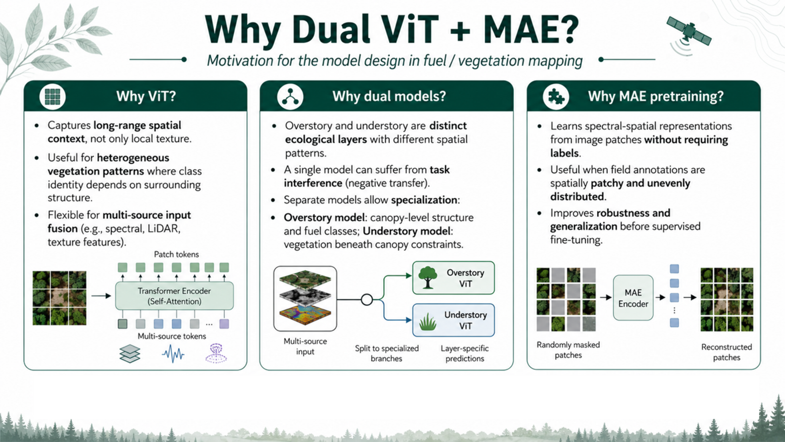
Why Vision Transformer models, dual vegetation-layer models and masked autoencoder pretraining?
Initial Results
The project produces maps that compare reference vegetatin labels with model predictions, showing how AI can identify grasslands, shrublands and forest classes.
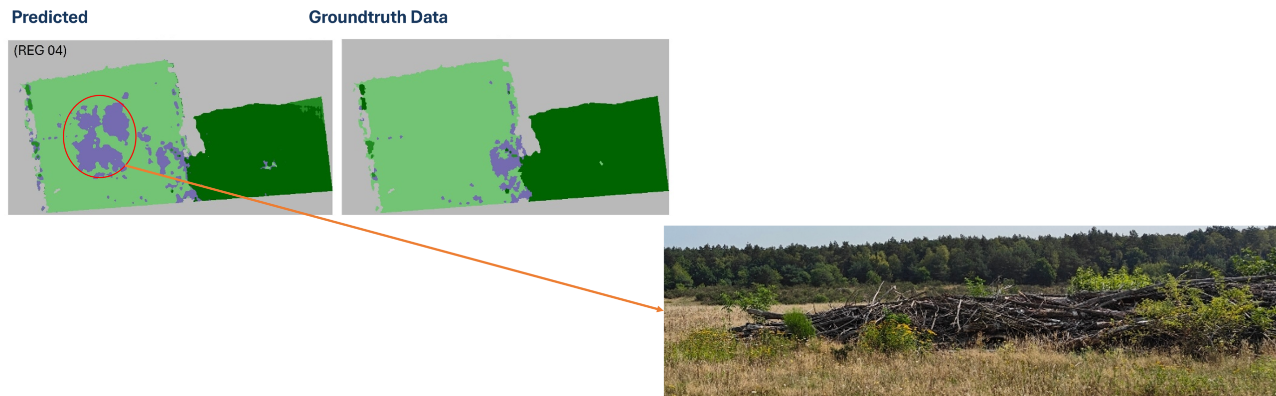
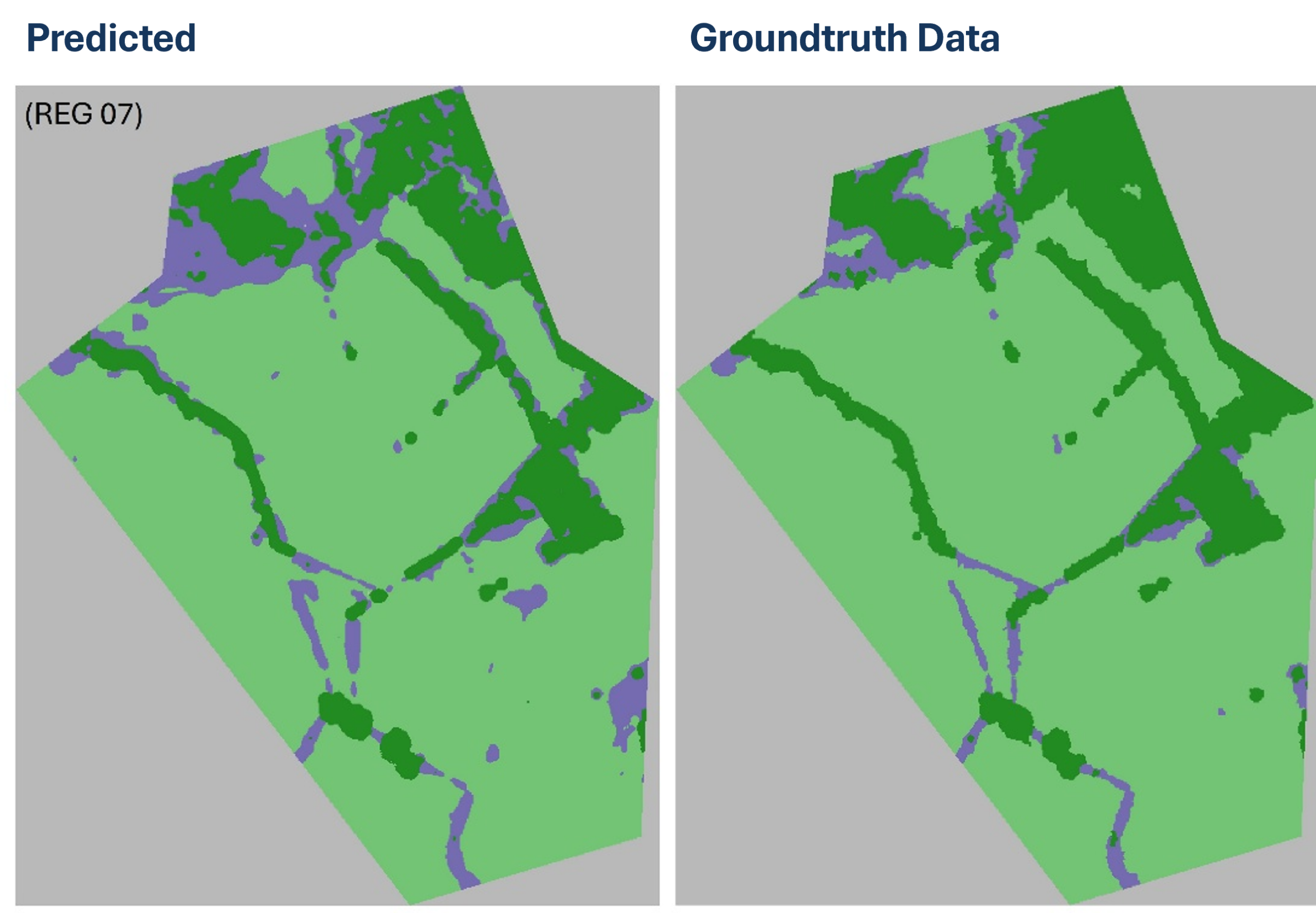
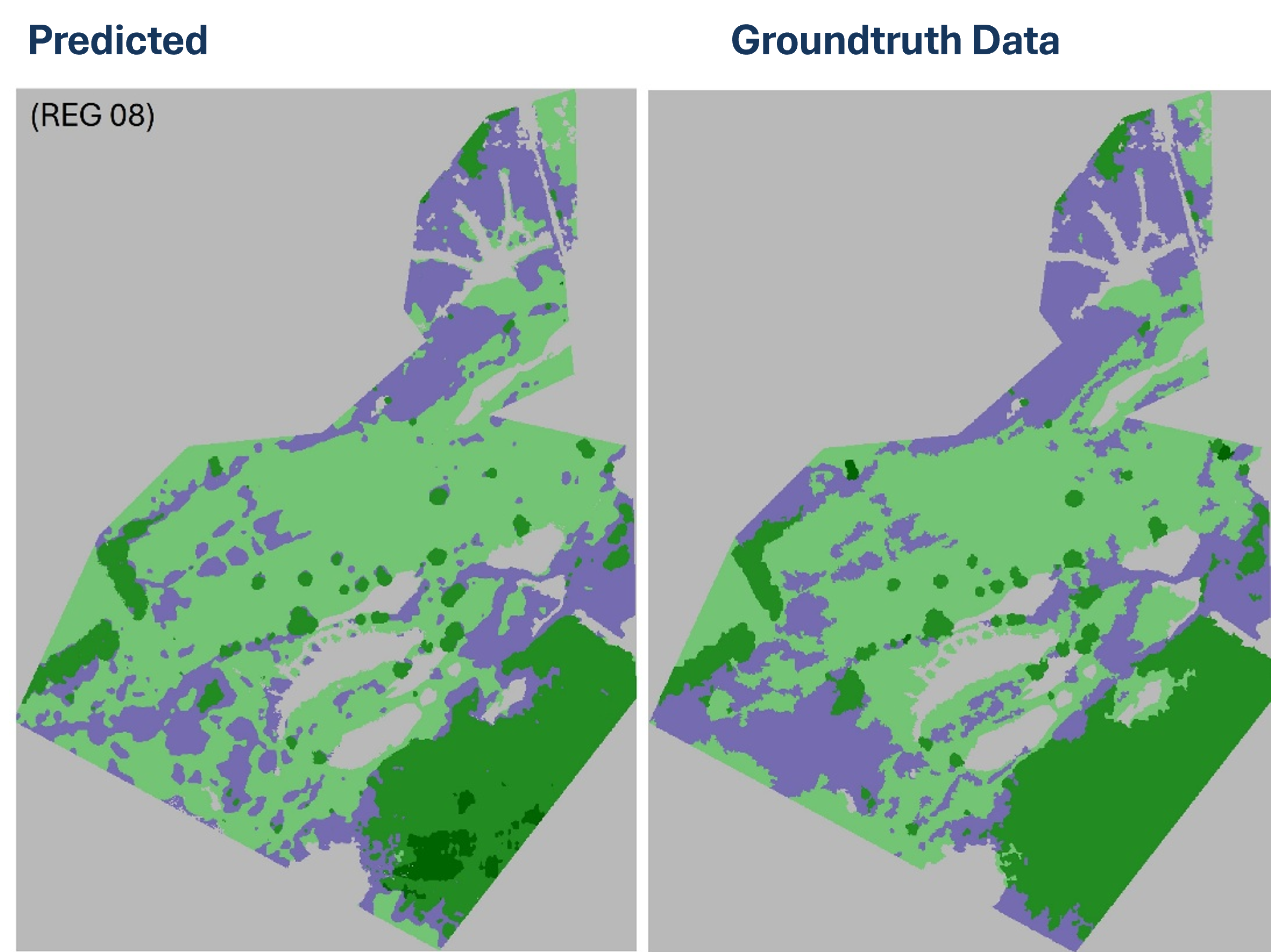

Comparison between reference vegetation labels and model predictions for three test study areas: (a) REG04-Maasmechelen; (b) REG07-Dorpsbemden, (c) REG08-De Maten, all located in Belgium.
Partners